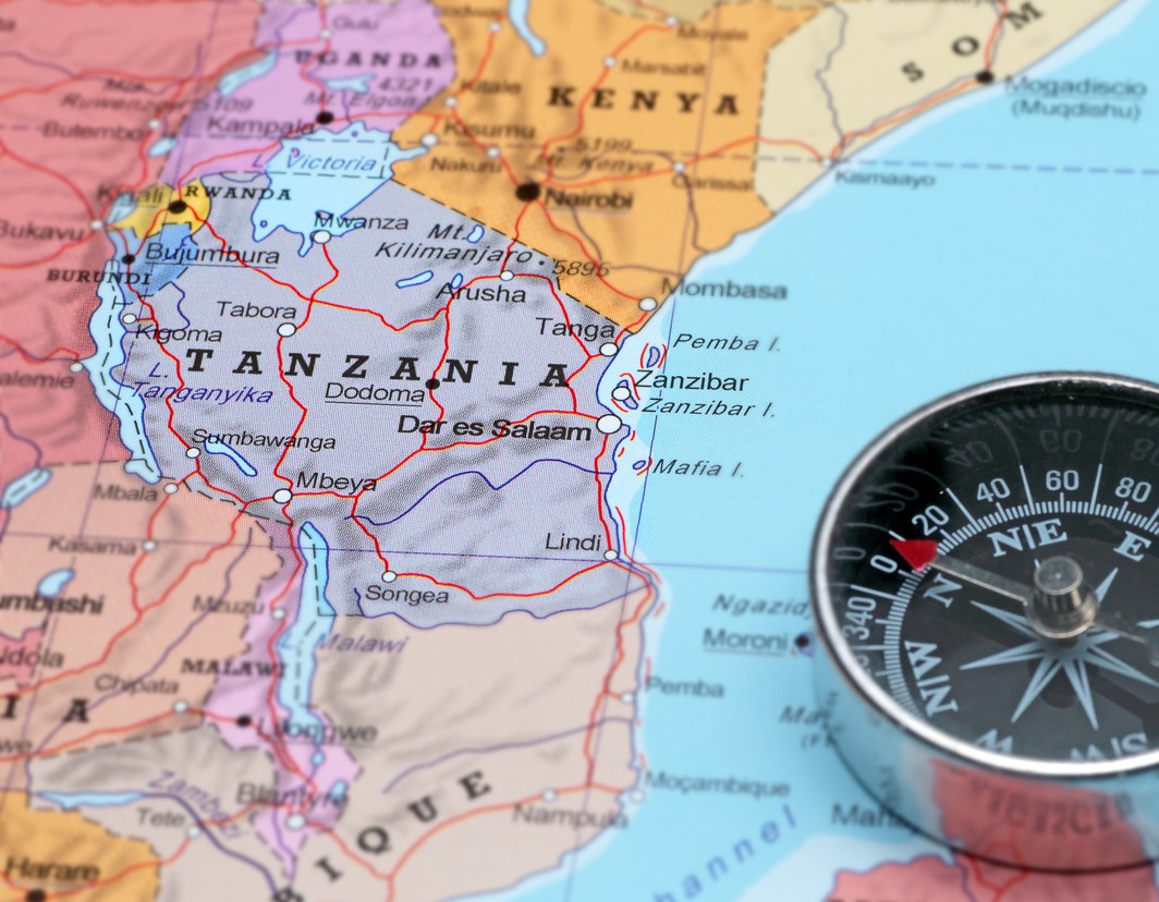
In preparation for my trip, I’ve been researching Tanzania. It is a country that lies in East Africa just south of the equator. It is part of the African Great Lakes region, and it is home to a lot of things I’ve heard of but didn’t know exactly where they were including:
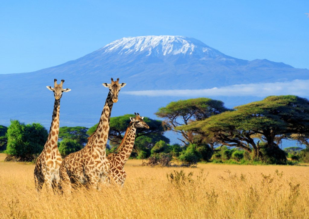
- (in the north) Mount Kilimanjaro (Africa’s tallest mountain), the Serengeti Plain, the Ngorongoro Crater, and some of the earliest evidence of human existence on earth (in Olduvai Gorge)
- (along the western border) Jane Goodall studied chimpanzees in the Gombe Stream National Park in Tanzania near the shores of Lake Tanganyika. Near the same lake is where, on 10 November 1871, explorer and journalist Henry Morton Stanley found the “missing” Dr. David Livingstone, missionary and explorer after a 2-year search instigated by the New York Herald newspaper.
Tanzania’s boundaries include Lake Tanganyika (world’s second deepest lake), Lake Victoria, and the Indian Ocean. Neighboring countries include Kenya, Uganda, Rwanda, Burundi, Democratic Republic of the Congo, Zambia, Malawi, and Mozambique. The country includes islands in the Indian Ocean, including: Zanzibar, Pemba, and Mafia. The name “Tanzania” comes from a blending of the names Tanganyika (the name for the mainland territory) and Zanzibar when the countries were united in 1964.
The coastal areas (in the east side of the country) are part of an old region called the Swahili Coast, and have a long history of trade. As a result of this trade and multi-culturalism, the Swahili language developed here from the local Bantu languages with a blending of the Arabic and Hindu of their trading partners. Today, Swahili is the lingua franca of the entire African Great Lakes region and beyond. Swahili is the national language of Tanzania and several other African countries. Outside the Swahili Coast, it is generally a second language as there are many local languages that people learn as their mother tongue. Wikipedia notes that “Over 100 different languages are spoken in Tanzania, making it the most linguistically diverse country in East Africa.”
The country’s international airports are in Dar es Salaam and Arusha (Kilimanjaro Airport). I’ll get to see both airports, at least twice, while I’m there because the airplane route is a triangle from Amsterdam first to Arusha and then to Dar es Salaam before heading back to Amsterdam. We start our journey in Dar (via Arusha) and leave the country from Arusha (via Dar es Salaam.)
Dar es Salaam is along the coast on the Indian Ocean. It sits on a natural harbor and is across the water from the island of Zanzibar. In 1865 or 1866, the city was founded by Sultan Majid bin Said of Zanzibar near an existing coastal fishing village Mzizima (Swahili for “healthy town.”) Dar es Salaam literally translates to “home of peace” (Dar = Arabic for house, es salaam = Arabic for “of peace”). Don’t you just love the meaning of those names?!
Dar was the administrative and commercial center of the region through various governments from 1887 – 1974 and effectively still today. In 1974, the government decided to move the official capital from Dar es Salam to an area more central to the country, and Dodoma was chosen (population of about 40,000 in 1974.)
The move has been slow. The parliament building was completed in 2006, and the National Assembly meets there now. However, embassies and government offices are still in Dar es Salaam.
When I mentioned the famous places in Tanzania, you may have noticed that the center of the country wasn’t included. The coast has the population, the growth, and the trade. The north has the wildlife, the Great Lakes, the archaeology, and population. The west also has wildlife and history (but not so much population.) The center of the country doesn’t get mentioned.
The German government did run a railroad from Dar es Salaam through the center of the country, establishing the City of Dodoma along the way in 1907. Otherwise, I have the impression that it was rural and didn’t get a lot of development or visitors. I’m sure I’ll learn more!
Putting the area of the country into context, both the World Fact Book and Encyclopedia Britannica note that the area of Tanzania is about twice the size of California. Dodoma City is in Dodoma Region. Wikipedia notes that the Dodoma Region is about the size of Switzerland, which when I lived there noted that it is about 1/3 the size of Wisconsin.
I built the following table while trying to compare areas, population, and population density with regions closer to home:
| Region | Area (square miles) | Population | Population Density (people/mi2) |
| Tanzania | 365,756 | 55,572,201 (2016) | 152 |
| United States | 3,796,742 | 327,167,434 (2018) | 86 |
| Switzerland | 15,940 | 8,508,898 (2018) | 534 |
| Dodoma Region | 15,950 | 2,083,588 (2012) | 131 |
| Minnesota | 86,936 | 5,697,718 (2018) | 66 |
| Wisconsin | 65,498 | 5,813,568 (2018) | 89 |
| Dane County, WI | 1,238 | 542,364 (2018) | 438 |
| Dodoma City | 1,000 | 410,956 (2012) | 411 |
| Twin Cities | 8,120 | 3,629,190 (2018) | 515 |
| Minneapolis | 58.4 | 425,403 (2018) | 7,284 |
| Madison, Wisconsin | 100 | 258,054 (2018) | 2,580 |
The area and population figures were pulled from Wikipedia (follow the links on the region’s name.) I calculated the population density based on those figures.
Speaking of population density, Encyclopedia Britannica notes that Tanzania has the largest animal population density out of any country in the world. Won’t that be something to see!

Great post Laura. Have a great trip and we’ll see all your pictures when you get back. I wish you the best and a lovely trip. Bill Jensen..
LikeLike
Thanks, Dad!
LikeLike
Very informative post! Have a great trip! Safari njema!
LikeLiked by 1 person
Great post and have a safe trip
LikeLike